Why Greenland Looks So Big: A Quick Guide to Map Distortion
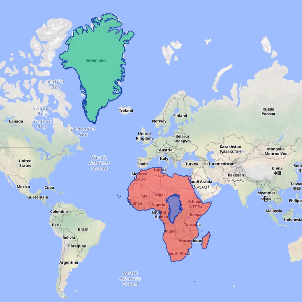
On many maps, Greenland looks as big as Africa. In reality, Africa dwarfs it. The culprit is projection distortion—especially on Mercator-family maps that expand areas away from the equator.
What Mercator preserves—and what it stretches
Mercator preserves angles (great for navigation) but blows up area toward the poles. By 60°N, scale is roughly 2×; by 80°N, nearly 6×. Because Greenland sits at high latitudes, its "map size" feels much larger than its real size.
See it on a true size map
Open our Interactive Map and add Greenland and Africa. Drag, rotate, and adjust opacity. Watch the center-latitude and exaggeration ratio—a live reminder that real size and "map size" are not the same.
More pairs to try:
Takeaway
No single projection is perfect. A true size map with interactive overlays makes the trade-offs tangible—so anyone can see the real size of countries, the real size of oceans and lakes, the real size of islands, and the true size of cities.