TrueSize.World : A Better Way to Compare True Size of Region
TL;DR — TrueSize.World is a true size map focused on showing the real size of places—countries, continents, oceans, lakes, islands, and cities—on one canvas. It highlights the perception gap you get on common web maps and makes comparisons fast, privacy-friendly, and easy to share.
What makes TrueSize.World different?
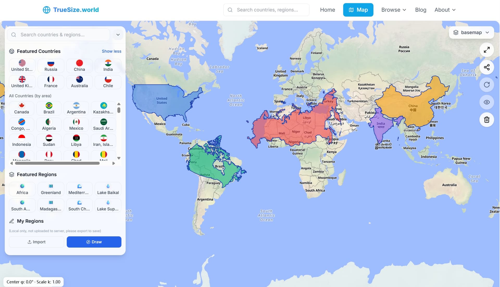
Most "the true scale of …" tools stop at countries. We go further: compare the real scale of countries alongside continents, oceans, lakes, islands, and cities on the same interactive stage.
Import your GeoJSON and draw shapes in your browser; nothing is uploaded. It's perfect for sensitive overlays in class, newsroom, or research.
Use opacity and rotation to make overlays readable and orientations comparable. Switch basemaps (standard / imagery / terrain) for context.
Web Mercator preserves angles but inflates areas away from the equator. We surface a live center-latitude readout and an exaggeration ratio so viewers grasp why "map dimensions" often differs from the real area.
Share link to reopen the exact true scale map state. Export GeoJSON for slides, docs, or further GIS work.
What you can compare today
👉 Try our Interactive Map: Open TrueSize.World
Why the "real map size" matters
If you've ever wondered why Greenland looks huge next to Africa on a classroom map, that's projection distortion talking. A true scale map makes it obvious: drag shapes to similar latitudes, rotate, and adjust opacity. The real size emerges immediately.